Trail Walking Le Sappey-en-Chartreuse - Sappey_Fort st Eynard - Photo
© OpenStreetMap contributors
Length
Length
7.6 km
Max alt
Max alt
1342 m
Uphill gradient
Uphill gradient
589 m
Km-Effort
Km-Effort  
15.5 km
Min alt
Min alt
986 m
Downhill gradient
Downhill gradient
589 m
Boucle
Boucle
Yes
Creation date :
2022-09-22 09:25:03.237
Updated on :
2022-09-22 14:03:08.049

(0 Reviews)

Walking
Walking
1h48
Difficulty : Easy

Scan this QR Code to open this trail in the SityTrail application

FREE GPS app for hiking

Logo SityTrail SityTrail

IGN / Geographical institutes

Download SityTrail from the App Store Download SityTrail from Google Play

Logo SityTrail SityTrail World

The world is yours!

Download SityTrail from the App Store Download SityTrail from Google Play Download SityTrail on Huawei AppGallery

About

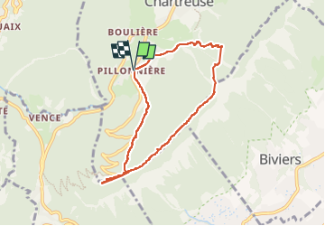
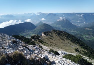
Trail Walking of 7.6 km to be discovered at Auvergne-Rhône-Alpes, Isère, Le Sappey-en-Chartreuse. This trail is proposed by Mich&Agnès.

Description

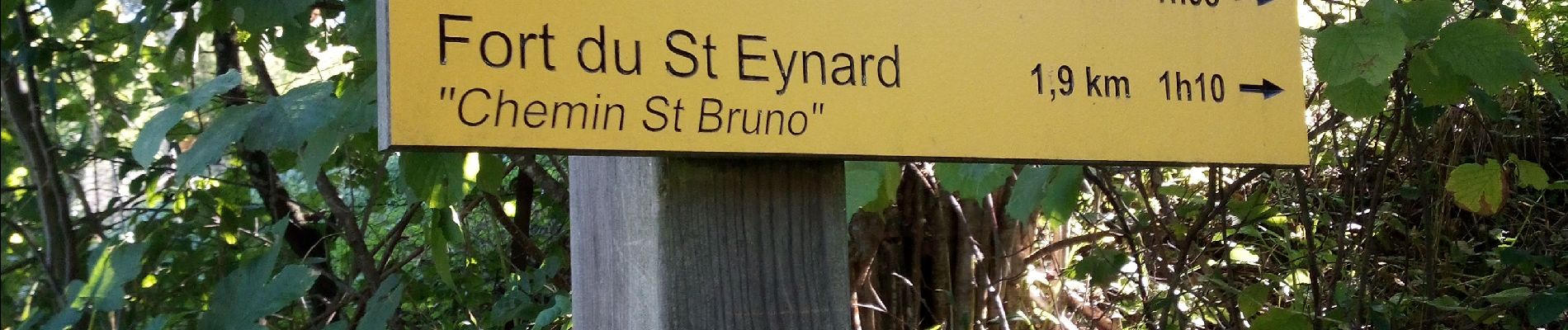
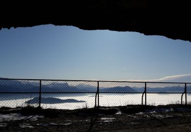
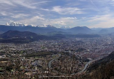
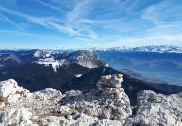
belle balade à couvert, de "beaux" panorama depuis la crête si on ne regarde pas en bas.

Elevation profile

Photos

Positioning

Country:
France
Region :
Auvergne-Rhône-Alpes
Department/Province :
Isère
Municipality :
Le Sappey-en-Chartreuse
Location:
Unknown
Start:(UTM)
717259 ; 5014396 (31T) N.

Trails nearby

Trail Walking Corenc - Mont Saint-Eynard par le Pas Guiguet  - Photo
Walking
cmarit

Walking

Difficult
(2)
Corenc, Auvergne-Rhône-Alpes, Isère, France
10.9 km | 26 km-effort
6h 5min
Yes
Trail Walking Sarcenas - Chamechaude par le Jardin, depuis le Col de Porte - Photo
Walking
tracegps

Walking

Difficult
(2)
Sarcenas, Auvergne-Rhône-Alpes, Isère, France
10 km | 23 km-effort
6h 19min
Yes
Trail On foot La Tronche - Grande Traverse de Meylan - Photo
On foot
PRO

On foot

Easy
La Tronche, Auvergne-Rhône-Alpes, Isère, France
5.6 km | 6.5 km-effort
1h 28min
No
Trail Walking Corenc - Mont Rachais par Corenc - Photo
Walking
flip38

Walking

Medium
Corenc, Auvergne-Rhône-Alpes, Isère, France
13.8 km | 25 km-effort
4h 26min
Yes
Trail Touring skiing Proveysieux - 140124 Mont Fromage - Photo
Touring skiing
mzonzon05

Touring skiing

Easy
Proveysieux, Auvergne-Rhône-Alpes, Isère, France
8.5 km | 18 km-effort
3h 21min
Yes
Trail Walking Biviers - Cresancoche - Photo
Walking
NANE51

Walking

Easy
Biviers, Auvergne-Rhône-Alpes, Isère, France
3.3 km | 6.2 km-effort
1h 12min
Yes
Trail Walking Sarcenas - Chamechaude en circuit partiel au départ du col de Porte - Photo
Walking
Emelle

Walking

Medium
Sarcenas, Auvergne-Rhône-Alpes, Isère, France
7.2 km | 16.8 km-effort
4h 20min
Yes
Trail Walking Le Sappey-en-Chartreuse - Belvédère de Roche Rousse en circuit - Photo
Walking
Emelle

Walking

Medium
Le Sappey-en-Chartreuse, Auvergne-Rhône-Alpes, Isère, France
12.7 km | 22 km-effort
5h 30min
Yes
Trail Walking Sarcenas - Col de Porte_Chamechaude - Photo
Walking
Mich&Agnès

Walking

Difficult
Sarcenas, Auvergne-Rhône-Alpes, Isère, France
8.8 km | 18.4 km-effort
3h 0min
Yes


Close
My subscriptions